Pilots Cafe Airplane Quick IFR Review Sheet Flashcards

Review for checkride

1
Q

Minimum aeronautical experience required for an airplane instrument rating

A

50 hours cross country pic time Of which 10 hours in airplanes 40 hours actual or simulated instrument time Of which 15 hours with CFII Including one cross-country flight of 250 NM Along are Waze or buy directed ATC routing An instrument approach at each airport Three different kinds of approaches using nav systems With a filed IFR Flight plan 3 hours in the last two calendar months prior to practical test

2
Q

Personal documents required for flight

A

Pilot certificate Medical certificate Authorized photo ID restricted radiotelephone operator license for flights outside the US

3
Q

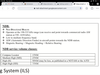
Aircraft documents required for flight

A

ARROW AIRWORTHINESS CERTIFICATE REGISTRATION CERTIFICATE RADIO STATION LICENSE INTERNATIONAL OPERATING LIMITATIONS AND AFM WEIGHT AND BALANCE DATA

4
Q

Aircraft maintenance inspections required for IFR

A

AVIATE ANNUAL INSPECTION EVERY 12 CALENDAR MONTHS VOR EVERY 30 DAYS 100 HOUR INSPECTION ALTIMETER, ALTITUDE REPORTING AND STATIC SYSTEM EVERY 24 CALENDAR MONTHS TRANSPONDER EVERY 24 CALENDAR MONTHS ELT EVERY 12 MONTHS

5
Q

Pre-flight info required for IFR

A

NWCRAFT NOTAMS WEATHER REPORTS AND FORECAST KNOWN TRAFFIC DELAYS ATC RUNWAY LENGTH OF INTENDED USES ALTERNATIVES AVAILABLE IF FLIGHT CANNOT BE COMPLETED AS PLANNED FUEL REQUIREMENTS TAKEOFF AND LANDING PERFORMANCE DATA

6
Q

Pre-flight self-assessment

A

IMSAFE ILLNESS MEDICATION STRESS ALCOHOL 8 HOURS BOTTLE TO THROTTLE .04% FATIGUE EMOTION

7
Q

Risk management and personal minimums

A

PAVE PILOT AIRCRAFT ENVIRONMENT EXTERNAL PRESSURES

8
Q

Logging instrument time

A

a person may log instrument time only for that flight time when the person operates the aircraft solely by reference to instruments under actual or simulated instrument flight conditions

9
Q

Instrument PIC recency of experience

A

Last six calendar months under actual or simulated instrument or Flight training device see me later in the same aircraft category logged 6HITS 6 INSTRUMENT APPROACHES HOLDING PROCEDURES AND TASKS INTERCEPT AND TRACK COURSES THROUGH THE USE OF ELECTRONIC NAVIGATIONAL SYSTEMS Or using an ATD, (approve pc-based flight simulator) 3 hours instrument experience holding procedures and tasks 6 instrument approaches 2 unusual attitude recovery in a descending Vne condition 2 unusual attitude recovery in ascending stall speed condition

10
Q

Instrument pic recency of experience, not current looking back 6 months, 12 months

A

Still log the requirements 6HITS get current with a safety pilot under simulated conditions instructor or Pilot examiner Safety pilot must be at least a Private Pilot with appropriate category and class, have adequate vision Ford and to each side of the aircraft when using a safety pilot the aircraft must have dual control system looking back 12 calendar months not current you need an instrument proficiency check by a CFII, examiner, or approved person

11
Q

To carry passengers as PIC

A

Three takeoffs and landings in the last 90 days in the same category, class and type at periods between 1 hour after sunset to 1 hour before sunrise three takeoffs and landings to a full stop During one hour after sunset to one hour before sunrise in the last 90 days. To act as pic flight review in the last 24 calendar months

12
Q

Obstacle departure procedure ODP

A

Only provides obstruction clearance Maybe flown without an ATC clearance unless a sid or other instructions are assigned Graphic ODP denote obstacle in chart title All new RNAV ODPS are available in graphic form Found in the front of NACO chart booklets arranged alphabetically by city name Jeppesen charts show ODP is under the airport diagram page or at larger airports on separate chart

13
Q

Standard instrument departure SIDs

A

Provide obstruction clearance and helps reduce radio congestion and workload by simplifying ATC clearances Pilot NAV SIDs pilot navigates by charter routes with minimal radio instruction Vector SIDS navigation is based on radar vectors routes are not printed on the chart some SIDS depict non-standard radio failure procedure File no SIDs in the remarks of your flight plan if you choose not to use them RNAV SIDS and all geographical RNAV ODPS require RNAV 1 performance

14
Q

Standard terminal arrivals STAR

A

Serves as a transition for men in route structure to a point from which an approach can begin Transition routes connect in route fixes to the basic STAR procedure Usually name according to the fix at which the basic procedure begins as with SID’s you may State no STARS in your flight plan remarks section if you choose not to use them RNAV STARS require RNAV 1 performance

15
Q

Do you need an alternate

A

1 2 3 RULE IF WITHIN 1 HOUR BEFORE TO 1 HOUR AFTER ETA FORECASTED WEATHER IS LESS THAN 2000 FOOT CEILING AND OR 3 STATUTE MILES VISIBILITY YOU NEED AN ALTERNATE If yes The alternate airport minimum specified in the procedure or if none: Precision approach: 600 foot ceiling and two statue mile visibility Non-precision approach: must be other than non waas GPS, 800 foot ceiling and 2 statute mile visibility Non instrument approach at the alternate:ceiling and visibility allowing descent from MEA approach and landing under basic VFR

16
Q

IFR Flight plan

A

Required before entering controlled airspace under IFR a clearance is also required How to file FSS in person, radio or phone DUATS online Through radio or phone with ATC File at least 30 minutes prior to estimated departure time stored in the system for 1.5 hours from proposed time of departure Cancellation Towered airports automatically canceled by ATC upon landing Non-towered airports you must contact ATC FSS to cancel Can cancel anytime not in IMC and outside class A airspace Preferred IFR routes are published in the airport facility directory AFD if a preferred route is published to your destination you should file it in your flight plan

17
Q

IFR minimum altitudes

A

Minimum prescribed or if none Mountainous area: 2000 foot above highest optical within 4 nautical miles of course Non mountainous areas:1000 feet above highest optical within 4 nautical miles of course

18
Q

IFR cruising altitudes based on magnetic course

A

From 0 to 179 degrees odd thousands of flight levels From 180 to 359 degrees even thousands of flight levels

19
Q

IFR minimum fuel requirements

A

Fuel from departure airport to destination Plus Fuel from destination to alternate if required Plus 45 minutes of fuel at normal Cruise

20
Q

Basic IFR departure clearance items

A

CRAFT Clearance Limit Route Altitude Frequency (for departure) Transponder Code

21
Q

Mandatory reports under IFR

A

MARVELOUSVFRC500 Missed approach Airspeed +/- 10kt or 5% change of filed TAS Reaching a hold fix VFR on top ETA changes +/- 3min Leaving a holding a fix/point Outer marker Unforecasted weather Safety of flight Vacating an altitude Final approach fix Radio/Nav failure Compulsory reporting points 500 unable climb/descent 500fpm Req. only in a non radar environment

22
Q

Position Reports items

A

Aircraft ID Position Time Altitude/flight level Type of flight plan (except for communicating with ARTCC/approach control ETA The name only of the next succeeding reporting point along the route of flight Any pertinent remarks

23
Q

IFR Takeoff Minimums

A

No T/O minimums mandated for part 91 operations Part 121,125,129,135 Prescribed T/O minimums for specific runway or, in none: 1-2 engines: 1SM visibility More than 2 Engines: 1/2 SM visibility

24
Q

Holding pattern timing

A

Adjust the outbound leg so the inbound leg takes: At or below 14,000 MSL 1 Minute Above 14,000 MSL - 1.5 minutes DME/GPS holds - fly the outbound leg to the specified distance from the fix / waypoint

25
Q

Max holding speeds

A

Up to 6000 MSL - 200KIAS 6001 - 14000 MSL - 230 KIAS Above 14,000 MSL - 265 KIAS May be restricted to 175 KIAS on some inst. approach procedures At Air Force fields - 310 KIAS At Navy fields - 230 KIAS *Unless otherwise depicted.

26
Q

IFR altitudes

A

DA/H - Descent Altitude/Height MAA - Maximum Authorized Altitude MCA - Minimum Crossing Altitude MDA/H - Minimum Descent Altitude / Height MEA - Minimum En route Altitude. Assures navigation coverage and 1000’ (non-mountainous terrain ) or 2000 (mountainous) obstacle clearance MOCA - Minimum Obstruction Clearance Altitude. Provides navigation coverage and obstacle clearance with 22NM of the NAVAID MORA - Minimum Off-Route Altitude MRA - Minimum Reception Altitude MVA - Minimum Vectoring Altitude OROCA - Off Route Obstruction Clearance Altitude. Assures obstacle clearance within 4 NM of course. 1000’ over non-mountainous terrain 2000’ over mountainous terrain.

27
Q

Lost Communications Procedure Altitude to fly

A

M.E.A. Minimum altitude prescribed for IFR Expected (e.g. expected 5000ft after 10min) last altitude Assigned by ATC

28
Q

Lost Communication Procedure Route to fly

A

AVEF Assigned route, if none: Vectored (fly to the fix/ route/ airway last vectored to), if none: last Expected route by ATC, in none: Filed route

29
Q

Leaving the Clearance Limit: Is the clearance limit a fix from which an approach begins?

A

Yes: Start descent and approach as close as possible to the EFC, or ETA (if no EFC given) No: At EFC or clearance limit (if no EFC given), proceed to a fix from which an approach begins and start the approach

30
Q

Do not fly a procedure turn when:

A

SHARPTT Straight in approach Holding in lieu of a procedure turn Arc Radar Vectored to final app course noPt depicted on chart Time approach Teardrop course reversal

31
Q

Instrument Approach Types Precision:

A

(Lateral + vertical course guidance) ILS - Instrument Landing System MLS - Microwave Landing System PAR - Precision Approach Radar GLS - GNSS Landing System TLS - Transponder Landing System

32
Q

Instrument Approach Types Non-Precision

A

(Lateral course guidance only): VOR NDB RNAV/GNSS (LNAV Minimums) LOC LDA - Localizer type directional aid, identical to a localizer but is not aligned with the runway. SDF - Simplified Directional Facility. Width: 6 degree or 12 degree. May be either aligned or not with the runway. ASR - Approach Surveillance Radar

33
Q

Instrument Approach Types: APV: (AProach with Vertical guidance) Has glide slope but does not meet ICAO precision app. Standards

A

RNAV/GNSS (LNAV/VNAV, LPV, baro-VNAV minimums) LDA with the glide slope

34
Q

When you can descend to next instrument approach segment?

A

When cleared for the approach and established on a segment of a published approach or route

35
Q

Standard rate turn angle or bank calculation

A

TAS / 10 +5 Example: 120ktas 120 ktas / 10 + 5 = 17 degrees of bank

36
Q

When can you descend below MDA/DA?

A

All three conditions must be met: 1) The aircraft is continuously in a position from which a descent to a landing on the intended runway can be made at a normal rate of descent using normal maneuvers. 2) The flight visibility (or the enhanced flight visibility, if equipped) is not less than the visibility prescribed in the standard instrument approach being used 3) At least on of the following visual references of the intended runway is distinctly visible and identifiable to the pilot: (except for CAT II & III approaches) a) The approach light systems, except you may descend below 100 feet above the touchdown zone only if the red terminating bars or the red side row bars are also visible and identifiable b) the threshold c) the threshold marking d) the threshold lights e) the runway end identifier lights f) the visual approach slope indicator g)the touchdown zone or its markings h) the touchdown zone lights i) the runway or runway markings j) the runway lights

37
Q

Aircraft approach categories

A

CAT: A (1.3 Vso, knots) <90 Circling radius 1.3NM B (1.3 Vso, knots) 91-120 Circling radius 1.5NM C (1.3 Vso, knots) 121-140 Circling radius 1.7NM D (1.3 Vso, knots) 141-165 Circling radius 2.3NM E (1.3 Vso, knots) >165 Circling radius 4.5NM

38
Q

Visual Descent point (VDP)

A

A defined point on the final approach course of a non-precision straight-in approach procedure from which normal descent from the MDA to the runway touchdown point may begin provided adequate visual reference is established. If not equipped to identify the VDP, fly the approach as if no VDP was published. When VDP is not published you can use this formula to calculate it: 10% of HAT = seconds to subtract from time to MAP

39
Q

Approach clearance Contact Approach:

A

Must be specifically requested by the pilot. (It cannot be initiated by ATC) Requires at least 1SM reported ground visibility and the aircraft to remain clear of clouds. Available only at airports with approved instrument approach procedures

40
Q

Approach clearances Visual approach

A

Initiated by either ATC or the pilot. Requires at least 1000’ ceilings and 3SM visibility. (IFR under VMC) Pilot must have either the airport or the traffic to follow in sight

41
Q

Minimum equipment required for flight

A

Page 5

42
Q

Minimum equipment required for flights for VFR day flight:

A

A – airspeed indicator T – tachometer (for each engine) O – oil pressure gauge (for each engine using a pressure system) M – manifold pressure gauge (for each altitude engine) A – altimeter T – temperature gauge (for each liquid cooled engine) O – oil temperature gauge (for each air cooled engine) F – fuel gauge L – landing gear position indicator A – anti collision lights (for aircraft certified after March 11th 1996) M – magnetic compass E – ELT S – safety belts

43
Q

Minimum equipment required for flights VFR night Flight

A

All VFR day equipment + F – fuses (one complete spare set) L – landing light (only if you are flying for hire) A – anti collision lights* P – position lights S – source of electricity (alternator, generator)

44
Q

For IFR day / night

A

For day: VFR gayequipment + GRABCARD for night: VFR day + VFR night + GRABCARD Generator or Alternator Radio/Navigation Appropriate For Flight Attitude Indicator Ball (Inclinometer) Clock Altimeter (Pressure Sensitive) Rate of Turn Indicator Directional Gyro

45
Q

Operating with inoperative instruments or equipment

A
46
Q

Standard VOR Service Volumes

A
47
Q

VOR limitations

VOR receiver Checks

VOR Check Sign off

A

VOR limitations:
􏰀 Cone of confusion.
􏰀 Reverse sensing.(if used incorrectly) 􏰀 Requires line of site to station.
VOR receiver checks: (§91.171) Every 30 calendar days.
􏰀 VOT ±4°
􏰀 Repair station ±4°
􏰀 VOR ground checkpoint ±4°
􏰀 VOR airborne checkpoint ±6°
􏰀 Dual VOR cross-check ±4°
􏰀 Above a prominent ground
landmark on a selected radial at least 20 NM from a VOR, flying at a “reasonably low altitude” ±6°
VOR check signoff: (§91.171) D.E.P.S
􏰀 D- Date
􏰀 E- Error
􏰀 P- Place
􏰀 S- Signature

48
Q

Distance Measuring Equipment (DME)

A

􏰀 962-1213 MHz (UHF).
􏰀 Normally tuned automatically with a
paired VHF station (VOR/LOC).
􏰀 The Airborne DME unit transmits an
interrogation signal.
􏰀 The ground DME facility receives and
replies to the interrogation.
􏰀 The time passed is used by the
airborne unit to calculate the slant range distance from the aircraft to the station.
􏰀 Slant range error is negligible at 1 NM from the DME station per every 1000ft.

49
Q

NDB:

A
50
Q

Instrument Landing System (ILS)

Localizer

A
51
Q

Instrument Landing System (ILS)

Glide Slope

A
52
Q

Instrument Landing System (ILS)

Marker beacons

A
53
Q

ILS Category

A
54
Q

Rate of decent for a 3degree glide slope:

A
55
Q

Area Navigation (RNAV)

A
56
Q

Global Positioning System (GPS)

A
57
Q
A
58
Q
A
59
Q
A